Secrets of the Ural Mountains. Journey in search of the Urals Geographical location of the Ural Mountains
Ural Mountains- a unique natural object for our country. You probably shouldn’t think too hard to answer the question why. The Ural Mountains are the only mountain range that crosses Russia from north to south, and are the border between two parts of the world and the two largest parts (macroregions) of our country - European and Asian.
Geographical location of the Ural Mountains
The Ural Mountains stretch from north to south, mainly along the 60th meridian. In the north they bend towards the northeast, towards the Yamal Peninsula, in the south they turn towards the southwest. One of their features is that the mountainous area expands as you move from north to south (this is clearly visible on the map on the right). In the very south, in the region of the Orenburg region, the Ural Mountains connect with nearby elevations, such as General Syrt.
No matter how strange it may seem, the exact geological border of the Ural Mountains (and therefore the exact geographical border between Europe and Asia) still cannot be accurately determined.
The Ural Mountains are conventionally divided into five regions: Polar Urals, Subpolar Urals, Northern Urals, Middle Urals and Southern Urals.
To one degree or another, part of the Ural Mountains is captured by the following regions (from north to south): Arkhangelsk region, Komi Republic, Yamalo-Nenets Autonomous Okrug, Khanty-Mansiysk Autonomous Okrug, Perm Territory, Sverdlovsk Region, Chelyabinsk Region, Bashkortostan Republic, Orenburg Region , as well as part of Kazakhstan.
Origin of the Ural Mountains
The Ural Mountains have a long and complex history. It begins back in the Proterozoic era - such an ancient and little-studied stage in the history of our planet that scientists do not even divide it into periods and eras. About 3.5 billion years ago, at the site of the future mountains, a rupture of the earth's crust occurred, which soon reached a depth of more than ten kilometers. Over the course of almost two billion years, this rift widened, so that about 430 million years ago an entire ocean, up to a thousand kilometers wide, was formed. However, soon after this, the convergence of lithospheric plates began; The ocean disappeared relatively quickly, and mountains formed in its place. This happened about 300 million years ago - this corresponds to the era of the so-called Hercynian folding.

New large uplifts in the Urals resumed only 30 million years ago, during which the Polar, Subpolar, Northern and Southern parts of the mountains were raised by almost a kilometer, and the Middle Urals by about 300-400 meters.
Currently, the Ural Mountains have stabilized - there are no major movements of the earth's crust observed here. However, to this day they remind people of their active history: from time to time earthquakes occur here, and very large ones (the strongest had an amplitude of 7 points and was recorded not so long ago - in 1914).
Features of the structure and relief of the Urals
From a geological point of view, the Ural Mountains are very complex. They are formed by rocks of various types and ages. In many ways, the features of the internal structure of the Urals are related to its history, for example, traces of deep faults and even sections of oceanic crust are still preserved.
The Ural Mountains are medium and low in height, the highest point being Mount Narodnaya in the Subpolar Urals, reaching 1895 meters. In profile, the Ural Mountains resemble a depression: the highest ridges are located in the north and south, and the middle part does not exceed 400-500 meters, so that when crossing the Middle Urals, you may not even notice the mountains.

View of the Main Ural Range in the Perm Territory. Photo by Yulia Vandysheva
We can say that the Ural Mountains were “unlucky” in terms of height: they were formed during the same period as Altai, but subsequently experienced much less strong uplifts. The result is that the highest point in Altai, Mount Belukha, reaches four and a half kilometers, and the Ural Mountains are more than two times lower. However, this “elevated” position of Altai turned into a danger of earthquakes - the Urals in this regard are much safer for life.

Typical vegetation of the mountain tundra belt in the Ural Mountains. The picture was taken on the slope of Mount Humboldt (Main Ural Range, Northern Urals) at an altitude of 1310 meters. Photo by Natalya Shmaenkova
The long, continuous struggle of volcanic forces against the forces of wind and water (in geography, the former are called endogenous, and the latter - exogenous) created a huge number of unique natural attractions in the Urals: rocks, caves and many others.
The Urals are also famous for their huge reserves of minerals of all types. These are, first of all, iron, copper, nickel, manganese and many other types of ores, building materials. The Kachkanar iron deposit is one of the largest in the country. Although the metal content in the ore is low, it contains rare but very valuable metals - manganese and vanadium.
In the north, in the Pechora coal basin, hard coal is mined. There are also precious metals in our region - gold, silver, platinum. Undoubtedly, Ural precious and semi-precious stones are widely known: emeralds mined near Yekaterinburg, diamonds, gems from the Murzinsky strip, and, of course, Ural malachite.
Unfortunately, many valuable old deposits have already been developed. The “Magnetic Mountains,” containing large reserves of iron ore, have been turned into quarries, and malachite reserves have been preserved only in museums and in the form of separate inclusions at the site of old mines - it is hardly possible to find even a three-hundred-kilogram monolith now. Nevertheless, these minerals largely ensured the economic power and glory of the Urals for centuries.
Text © Pavel Semin, 2011
website
Film about the Ural Mountains:
How the Ural Mountains were born
The Urals on Earth is a unique phenomenon.
And in its role as a planetary suture that once held two great continents together.
And because of the abundance of natural landscapes here, scattered generously throughout its entire space.
And in terms of climatic diversity.
In fact, where else will you find such a region, where the head would be cooled by the centuries-old ice of the Northern Ocean, and the foot would be scorched by the calcined sands of the deserts? A land where, on the same June day, the never-setting sun shines over the blooming polar tundra and the herbs of alpine meadows luxuriously spread out. Where you can hunt to your heart's content in the cedar trees or, after admiring the harmonious choirs of elegant birch tufts, stop at a Bashkir nomad camp, drink plenty of chilled kumiss, while watching how everything around vibrates in the sultry steppe haze...
And now from these poetic pictures of the Ural region we will have to move on to more prosaic, but very necessary for our story, things. It is not without interest, I think, to understand for ourselves how such an unusual natural creation appeared on the body of the planet, what forces erected it. Therefore, a short excursion into the science that studies the Earth is inevitable - into geology.
What does modern science define by the concept of “Ural”?
Strictly speaking, the Urals are a mountainous country with areas of two great plains adjacent to it from the west and east. Why geologists think so will be discussed later. As mentioned earlier, the Ural mountainous country lies on the planet in a rather narrow strip, the width of which rarely exceeds one hundred and fifty kilometers, and it stretches from the Aral deserts to the Arctic Ocean for more than two and a half thousand kilometers. In this way, it is similar to many mountain ranges known on Earth - the Andes, for example. Only the mountains in the Urals, although often rocky, are much lower, less steep, more ordinary, or something, than their famous counterparts somewhere in the Alps or Himalayas.
But if the Ural Mountains outwardly do not amaze with anything, then the content of their subsoil is completely unique.
The Urals are world famous for the richness and diversity of their geological structure. This is an irrefutable truth. But we must understand the significance of this fact to the subtlest shade - the Urals are perhaps the only place on Earth where specialists have found rocks formed in almost all periods of the planet’s existence. And minerals, the appearance of which could be due to the existence here (of course, at different times) of all conceivable physical and chemical regimes both in the bowels of the Earth and on its surface. Some kind of utter mishmash of geological creations of different ages and different characteristics!
But that's not all.
The abundant list of geological formations of the Urals naturally includes a uniquely wide range of the richest deposits of almost all minerals known on our planet. Oil and diamonds. Iron and jasper with marble. Gas and malachite. Bauxite and corundum. And... and... and... The list is endless - not everything has been discovered yet, and we still don’t know all types of minerals.
All this - the diversity that amazes even experienced professionals, the abundance of subsoil treasures, and their unprecedented diversity of ages - all this has made the Urals a geological Mecca for the world community. This began from the time of Peter the Great - and has not ended to this day. “Everyone flashed before us, everyone was here...” Historians claim that the Russian Geological Committee, created by royal command more than a hundred years ago, was established mainly so that scientists could finally decide on this natural disaster, called the Urals...
Only... just a huge number of studies did not simplify the solution of the problem for which academic luminaries came to the Urals. Problems of understanding - how does it all come together here?!
Listing all the created hypotheses for the formation of the Urals is not a task for a short essay. An extensive monograph is needed here. After all, the contradictory nature of observations verified and rechecked a thousand times has created an incredible kaleidoscope of facts. The researchers had to logically reconcile the obvious reality of finding literally the most heterogeneous sediments nearby. And the siliceous slabby fragments of the formations of the ocean floor, which raged here three hundred to four hundred million years ago, are now crushing underfoot. And boulder ridges, brought deep into the ancient continent by glacial massifs hundreds of thousands of years ago. And outcrops of rocks of the granite or gabbro series, now being destroyed by the winds and the sun, but which could only have formed at many kilometers of the earth’s depths, in the dark crucible of thousand-degree temperatures and many-thousands of atmospheric pressures that reign there. And the sandy spits of river sediments that have washed here more than one million tons of sand and pebbles from the collapsing mountains...
So to this day, all this allows dozens of very different assumptions to exist simultaneously on equal terms about how the Earth lived within the Urals throughout its billion-year history. To this day, deciphering its true history is a pressing and complex problem for geologists.
True, today scientists have at least decided on the criterion by which they share the hypotheses of the formation of the Ural mountainous country.
This criterion is cosmogonic.
He finally made it possible to group all points of view according to their relation to the original substance of planet Earth.
Supporters of one approach agree that all celestial bodies visible from the Earth - including planets - were formed as a result of the convergence and compaction of previously scattered cosmic proto-matter. It was either the same as the meteorites currently falling on our planet, or it was a scrap of fiery liquid melt. The creators of hypotheses based on this premise include the philosopher Kant, the famous mathematician and astronomer Laplace, and the outstanding Soviet researcher Otto Yulievich Schmidt. By the way, in Soviet schools, hypotheses from this series were studied mainly. And they are not so easy to dispute - meteorites continue to regularly pierce the Earth to this day, increasing its mass. And that to this day the earth’s core is liquid, probably not a single geologist doubts. And the law of universal gravitation still regularly determines the course of the stars and planets.
Proponents of another approach argue that all planets (the Earth, of course, is no exception for them) are fragments of proto-matter, formed as a result of its explosive expansion, that is, in their opinion, there is a process of decompression of the matter of the Universe. The great Lomonosov did not deny such a view; many leading geologists and cosmologists of the world and our country now adhere to it...
And their conviction is understandable. Astronomers have found that when going towards Earth, the light from all visible stars shifts to the red part of the spectrum. And there is only one satisfactory explanation for this - all the stars fly away from a certain center. This is a consequence of the decompression of space matter.
According to the latest estimates, our planet has existed as a separate celestial body for about four and a half billion years. So: in the Urals, rocks have been found whose age is determined to be no less than three billion years old. And the whole “tragedy” for supporters of the hypotheses is that this established fact is easily explained from the positions of both points of view...
How did the Urals live from the birth of the planet to the present day? Naturally, here, too, two different pictures are offered. Supporters of the “shrinking” Earth believe that all this time the Urals behaved like an oscillating string (of course, slowly oscillating and, of course, a huge string) - it either rose to the heavens, bristling with rocky mountain peaks, or descended, bending towards the earth’s center, and then - throughout the entire depression - it was flooded by oceanic swells. Naturally, these fluctuations were not so simple, consistent and unidirectional. During them, there were chips and ruptures of the earth's firmament, and the crushing of individual sections of it in the corrugation of folds, and the formation of cracks of different depths. Water rushed from below and above into the gaping gaps of the cracks, streams of red-hot lava burst out of the bowels of the earth, and clouds of volcanic ash covered the sky and the sun, spewing out of the vents of fire-breathing volcanoes. There are many deposits of this type in the Urals.
Globe of Martin Behaim (1492)
During the uplift of sections of the Urals, debris, pebbles, and sand usually form on them. During subsidence, rivers carried destroyed material into the oceans and seas, filling their coastal zones with clay, silt, and sand. Dying microorganisms created kilometer-long layers of limestone and other typically oceanic geological formations in the seas...
And all these breeds are in abundance in the Urals, which, according to supporters of the first approach, is quite enough to recognize it as true.
Proponents of a “disconnecting” Universe believe that the Earth expanded in leaps and bounds. The picture he paints of the formation of the Urals is as follows. With the next significant expansion of the body of our planet, it shuddered, cracked, and huge continental blocks, broken by the expanding substance of the earth’s interior that was bursting them apart, slowly, as if in an ice drift, crawled across the face of the planet. (By the way, it has been established that all continents are still doing this, each moving in its own direction at a speed of up to several centimeters per year.) The space between the continents began to quickly fill with puffing gases and molten matter from the deep interior. From there, huge masses of salty waters of the future oceans and seas, formed during the same process of decompression, splashed out onto the earth's surface. This was the case in modern oceans.
This is how the Urals were formed. The fragments of the ancient continents, moving away from each other along the roundness of our planet, on the other hand, inevitably had to come closer to some other fragment, also from a previously intact piece of land. This is how Europe, which had broken away from something, and Asia, which had broken off from somewhere, began to come closer together. When colliding, the edges of the approaching fragments began to crumble, crumple, and prick. Some pieces of the converging continents were squeezed out onto the surface of the Earth, some were crushed inward, crushed into folds. Because of the gigantic pressures, something melted, something stratified, something completely changed its original appearance. A monstrous jumble of the most heterogeneous formations was formed, which humorous geologists dubbed a “broken plate.” The squeezed out blocks of rocks formed chains of Ural ridges along the line of contact of materials.
What was described, according to the authors of this idea, happened quite a long time ago, hundreds of millions of years ago. But one should not think that this was the last act of expansion of our planet. Geologists believe that faults in the earth’s crust within the Urals have occurred more than once since then. They consider one of the last events of this kind to be the formation of a split in the Southern Urals, stretching in a line from Bredy through Troitsk to Kopeisk. Here, according to enthusiasts of the idea, is the birth of such a crevice in the earth's firmament, which can, in a couple of hundred million years, grow to the size of the Atlantic Ocean. She's just at the very beginning of this glorious path. The next stage they see is the formation of a giant depression like Baikal - in about a hundred thousand years, then the spreading shores of the nascent sea (like the Red Sea) - in another two or three hundred thousand years, and then a direct path to the new Great Ocean. It would be interesting to see...
The places where continents collide are also riddled with numerous cracks and become easily permeable to ore-bearing solutions.
From the perspective of these approaches, the abundance and wealth of mineral resources in the Urals can be easily explained...
No matter how they appeared on the body of the planet, the Ural Mountains for the last few tens of millions of years have invariably risen on the border of two continents, open in winter and summer to all winds, rains, snows, baked by the sun, frozen by frosty winters. All natural elements contributed to the destruction of the once majestic ridges. The tops of the mountains gradually collapsed, crumbled into countless fragments of small and large blocks, and became lower and rounder. So they gradually turned into what we see today - into a community of several closely spaced, not too high and not too rocky chains of mountain ranges, stretched for the most part almost strictly from south to north (or vice versa). It should be noted that in the south and north of the Ural mountainous country, its mountains are both higher and more rocky. In its central part they are significantly lowered, in some places they are just high, dignified hills.
And one more feature in the structure of the Ural Mountains can be noticed by a traveler crossing them from west to east. The mountainous country is asymmetrical in the latitudinal direction. It transitions into the Russian Plain as if smoothly, through a series of gradually descending western foothills. Its transition to the West Siberian Lowland is more abrupt. In a significant part of the Urals it looks like this: mountains, mountains, mountains, a cliff - and immediately a low, swampy Trans-Urals region.
The modern climatic zones of the Urals were formed relatively recently, in the last couple of hundred thousand years, almost immediately before the settlement of the Urals by humans. At that time, the most distinct traces of cooling appeared on the planet. They have been fairly fully traced throughout the entire length of the Ural Mountains, and have also manifested themselves in changes in vegetation and the species composition of the animal world. The cooling of the planet led to its glaciation. But an interesting detail: if in the European part of our country the tongues of glaciers penetrated to the latitude of modern Dnepropetrovsk, then in the Urals, even at the time of the deepest glaciation, they did not penetrate south of the upper reaches of the Pechora.
Judging by fossil vegetation, before the last ice age the climate in the Urals was quite favorable. Here - almost along the entire length - then hop hornbeams (a tree of the Mediterranean climate, found in the Pechora River basin), oaks, lindens, hornbeams, and hazel grew. Shrubs were abundant, and a variety of grass spores and pollen were found. But during the glaciation period, not a trace remained of the free forest-steppe open forest with vast open spaces. It was replaced by taiga coniferous forests, and the luxurious herbs in large areas were replaced by quinoa and wormwood.
In pre-glacial times, the level of the World Ocean was one hundred fifty to two hundred meters lower than today. On the shelves of the modern northern seas, many kilometers of once-deep valleys, then dug into the earth's surface by Pechora and Ob, have been discovered. And Kama’s bed lay one hundred and fifty meters below its current level. The peaks of the Ural Mountains were on average 200–500 meters higher than the modern level. And since the mountains were higher, the rivers originating in them flowed faster. In general, powerful streams flowed from the Urals at that time. Evidence of their power is now the scattering of boulders that they carried from the mountains far to the plain. Such boulders - up to one and a half meters in diameter - can often be found while walking in the vicinity of Khanty-Mansiysk.
And the Ural rivers were much more water-rich.
Today the small river Khmelevka flows near the Cherry Mountains. Such a homely, meek Cinderella. And it has been established for sure that it was once a very, very large river; it flowed along the western slopes of the Potanin and Vishnevy mountains, absorbing the valley of the present Gorkaya River, and flowed into the present lakes Bolshoy and Maly Kochan and Ara-Kul. Then these lakes were one huge whole - the sea, and now only in the deepest places of the ancient basin mirrors of its waters have been preserved.
Apparently, it is not without reason that the time of melting glaciers from the era of the largest glaciation in the Urals received the name “time of great waters” from experts.
In general, periods of glaciation seriously affected the formation of the modern appearance of the Urals. And not only the Urals. Let me introduce you to one hydrographic incident that happened at that time.
We have already mentioned above that the ice sheets on the Russian Plain reached the bend of the Dnieper near modern Dnepropetrovsk and the latitude of the city of Ivdel in the Urals. The glaciers completely blocked and reshaped the hitherto familiar structure of river flows. Thus, the rivers of the Pechora basin began to flow into the Kama - through Vyatka. The glacier formed an insurmountable wall under the pond and water of an ancient large river that once flowed in the area between the current cities of Yuryevets and Vasilsursk. It flowed north and flowed into the ancient Unzha, which then belonged to the Don basin. The dammed waters, constantly replenished by the melting glacier, overflowed the bowl of the emerging reservoir and, pouring through the heights of the watershed near present-day Kazan, poured into the streams of the Kama. Gradually they completely sawed through this watershed and formed a completely worthy river bed. This is how the great Volga River appeared.
Considering the further process of formation of the Volga basin, geologist G. F. Mirchink came to the conclusion that it “... is, in essence, the story of the strengthening of the power of the Kama. The tributaries of the Kama, gradually increasing in power and number, created the modern Volga. Historically, in the geological sense of the word, it would be more correct to consider the Volga a tributary of the Kama..."
Isn’t it deeply symbolic that the streams of the Ural river Kama modestly and inconspicuously turned into the great Russian river Volga?
Is it not from such a hydrogeological fact that the tradition began, according to which all the abundant power of the Urals unobtrusively, quietly, but significantly began to be personified by the power of Russia...
Since the time of the first great glaciation of the Urals, all its main climatic landscape zones appeared and have been preserved to this day - tundra (alpine), mountain-taiga, taiga-plain, forest-steppe and steppe.
This is how everything developed in the Urals by the time man appeared here.
From the book One Day in Ancient Rome. Everyday life, secrets and curiosities author Angela AlbertoCurious facts How the largest baths of the empire were born A radical revolution in the classical concept of baths was carried out by the same Apollodorus of Damascus, the architect whom we met at the Forum of Trajan. This construction of his will serve as a model for all major imperial
From the book Secrets of Lost Expeditions author Kovalev Sergey AlekseevichBarents' ship was found in the expected location, but new secrets were born. Vladlen, a participant in several search expeditions, spoke in more detail about the search and discovery of Willem Barents's ship in the collection "The Arctic Circle" in 1982
From the book Reconstruction of True History author2. The Ural cities of the allegedly Bronze Age are traces of Moscow Tartary, that is, the Siberian-American state of the 15th–18th centuries. Relatively recently, many settlements were discovered in the Southern Urals, among which the most famous was Arkaim, ch. 11. Historians named them
From the book Book 1. New chronology of Rus' [Russian Chronicles. "Mongol-Tatar" conquest. Battle of Kulikovo. Ivan groznyj. Razin. Pugachev. The defeat of Tobolsk and author Nosovsky Gleb Vladimirovich4. Numerous Ural cities supposedly of the Bronze Age, among which Arkaim is the most famous, are most likely traces of Moscow Tartaria, that is, the Siberian-American state of the 15th–18th centuries AD. e Relatively recently, quite a lot was discovered in the Southern Urals
From the book Pugachev and Suvorov. The Mystery of Siberian-American History author Nosovsky Gleb Vladimirovich14. Numerous Ural cities supposedly of the Bronze Age, including the famous Arkaim, are traces of the defeated Moscow Tartary of the 18th century AD. e Relatively recently, quite a lot of old settlements were discovered in the Southern Urals, among which the most famous is Arkaim,
From the book Reconstruction of True History author Nosovsky Gleb Vladimirovich2. The Ural cities of the allegedly Bronze Age are traces of Moscow Tartary, that is, the Siberian-American state of the 15th–18th centuries. Relatively recently, many settlements were discovered in the Southern Urals, among which the most famous was Arkaim, ch. I. Historians named them
From the book Everyday Life in Greece during the Trojan War by Faure PaulMountains 80% of Greece at that time consisted of mountains - fragments of the gigantic arch of the Dinaric Highlands, endlessly intricate, rugged and diverse. Looking at them, you understand and justify the political fragmentation of the country, its division into many small cantons and
From the book Secrets of Ancient Civilizations. Volume 1 [Collection of articles] author Team of authors From the book My Son - Joseph Stalin author Dzhugashvili Ekaterina GeorgievnaMountains The mountain is piled above the mountain, Crowned with the shadow of an eagle. Born in the abyss of the flood, giants dressed in snow. Now the sun looks like into a loophole, Now a flock of clouds rushes in, The roar of a half-killed leopard Thunder is answered fiercely... The horns collide together Under the roar of a fallen avalanche, And the cold
From the book In Search of the Lost World (Atlantis) author Andreeva Ekaterina VladimirovnaSunken Mountains As a result of such measurements, it turned out that the entire middle part of the Atlantic Ocean floor is occupied by an underwater mountain range. This ridge runs from north to south and is a colossal mountain system that begins off the coast of Iceland and stretches
From the book Secrets of the Gray Urals author Sonin Lev MikhailovichURAL CONQUISTADORS So, in the middle of the sixteenth century, after the birth of Christ, the Urals and the Urals were almost completely annexed to Russia. What soon became obvious was a great event. And not only for the fate of our country. Entry of these lands into Russia
From the book Argonauts of the Middle Ages author Darkevich Vladislav PetrovichUral treasures In the interfluve of the Kama and Vyatka, among forests, swamps and low hills, the village of Turusheva was lost. In the summer of 1927, one of many treasures of “Oriental silver” was found here. A boy tending a herd at the edge of the forest suddenly fell into a hole. Feeling in her
From the book Russian Entrepreneurs and Philanthropists author Gavlin Mikhail LvovichUral breeders from San Donato No less interesting and bright personality in the Demidov family was Anatoly’s nephew Pavel Pavlovich Demidov, a representative of the new generation of the dynasty. His name is associated not only with charity and patronage of the arts, but also with active
From the book Book III. Great Rus' of the Mediterranean author Saversky Alexander VladimirovichMountains The description of geographical objects in written sources, relating to the stage of the creation of Eastern Rus', contradicts modern ideas about its location, and therefore, as a rule, is considered erroneous. Nevertheless, we will turn to them, based on the fact that the ancients
From the book Russian Explorers - the Glory and Pride of Rus' author Glazyrin Maxim YurievichMountains In the mountains, N.I. Vavilov always feels a special elation. It’s better to think here. 1928. N.I. Vavilov’s second son, Yuri, was born in 1929, January 10. N.I. Vavilov holds the All-Union Congress on genetics, selection, seed production and livestock breeding. At the congress
From the book Introduction to Historical Uralistics author Napolskikh Vladimir VladimirovichPart I. Ural peoples: basic information on ethnicity
There was a wary silence in the round hall of the Presidium of the USSR Academy of Sciences. The chairman of the newborn academic Ural Scientific Center, academician Sergei Vasilyevich Vonsovsky, represented the science of his region: a whole division of researchers - 30 thousand people, of which more than two dozen members of the academy, 500 doctors and 5 thousand candidates of science. The government acted farsightedly. It’s enough for the scientific Urals to be considered “sons”, or, speaking in Latin, to be a branch. Now it itself has become a center uniting forty universities and 227 (two hundred twenty-seven!) research institutions. In a word, a big ship has a long voyage.
But as to where the ship should sail, opinions in the room were divided. “Only applied work, searching for minerals,” some said, “after all, the Ural subsoil no longer provides the Ural industry.” “No,” the opponents objected, “the search cannot be conducted blindly. We need fundamental research that will restore the history of the formation of the Ural Mountains.” “But the Urals have been studied almost better than any other region of the globe. All the main geological theories were tested on the Ural touchstone...”
- So, the damned Volga still flows into the Caspian Sea? — my classmate at Moscow State University, now an assistant professor, beckoned me into the corridor. - Hide the notebook. This dispute, let it be known to you, is meaningless: there are no Ural Mountains anyway.
Without giving me time to come to my senses, the assistant professor pulled me towards the map.
“Of course,” he continued, “any student in my exam can say that the Urals are a mountainous country stretching from the Kara Sea to Mugodzhary, which separates the Russian Plain and the West Siberian Lowland - I will be forced to give him an A.” This is the tradition, although it is still not good to deceive babies... You, my brother at Moscow State University, must know the truth. Let's look north; some continue the Ural ridge on Novaya Zemlya, others turn it to Taimyr, and others drown it in the Kara Sea. What's in the south? Mugodzhary is not at all the southern tip of the Urals, the mountains continue, but no one knows where - either they stretch to the Tien Shan, or end at Mangyshlak. It’s the same story with the western and eastern borders...
- But the Ural ridge still exists!
- Hm... The luminary of geology of the last century, Impey Murchison, argued that the Urals mountains have western and eastern slopes. Hundreds of researchers have been repeating this for many years, although they know very well that, for example, in Sverdlovsk there is no watershed. The Chusovaya River calmly flows through the center line from the eastern “slope” to the western, violating all the “scientific principles” of Murchison and his followers... That’s it. And if we consider the Urals as a geological concept, then it is generally unclear whether it stretches from north to south or from east to west and whether this ridge exists in nature.
- Well, you know!
- And you go to Sverdlovsk and see everything for yourself. There is a revolution in geology now, and its epicenter is in the Urals. Now this is happening there... From there we can see the future of the Ural center, and the future of geology itself, and the future of everyday practice itself.
In Sverdlovsk they argue about the oceans
Sverdlovsk is one of the most “land” cities on the planet. And not only because the Iset River cannot be reached to any sea: it is repeatedly blocked by dams within the city. Even Neptune's breath does not reach here. The Pacific Ocean is too far away, the Atlantic wind weakens long before the Urals. You can feel the proximity of the Arctic, but it is no longer a water basin, but an icy country. In general, where is the sea, and where is Sverdlovsk...
And yet, the biggest event of the young scientific center in the summer of 1971 was precisely the discussion about the ocean. One respected Moscow academician has just returned from a voyage on the Vityaz. He brought with him samples of the Earth's mysterious mantle.
The scientists took their places in the spacious hall: the venerable ones were closer to the podium, the young ones were behind.
— They are preparing for a discussion as if for a battle. They even take up places like fighting positions - “mobilists” on the left, “fixists” on the right,” whispered a young Sverdlovsk geologist I knew.
- Where should the speaker sit then?
- On the left. He was already sitting on the right. You see, for a very long time geology was a science not about the whole earth, but only about the land. Recently, major discoveries have been made in the ocean. We had to reconsider old concepts and put forward new hypotheses. “Mobilism” was revived, but on a new basis.
- Who are you for? Which hypothesis is closer to you?
Instead of answering, the geologist took me to the wall newspaper “Earth”. Crossed out in red pencil, there was the inscription: “A hypothesis is an attempt to turn a problem from its head to its feet, without first establishing where its “legs” are and where its “head” is.” By hanging their wall newspaper next to the announcement of the lecture, the young geophysicists apparently sought to inject something of KVN into the discussion. “Every lowland strives to become a highland, and this is a real natural disaster.” Perhaps, this is not only about the earth’s surface... But, it seems, a pin for some of the venerable: “It’s not enough to be Magellan. There must be somewhere the Strait of Magellan that you discovered.”
— Take a closer look, next to you is the main opponent of today’s speaker...
The opponent skimmed the aphorism: “You don’t have to be a fossil to be useful.” Thought about it. Then another one: “All forces on earth are opposed by one and only one - the force of inertia.”
“Well, without resistance there is no movement forward,” he smiled at my interlocutor.
It depends on everyone, but I liked this attitude of the young center.
A person who comes to a scientific debate for the first time sometimes feels uneasy. He often cannot even understand what we are talking about and where, in fact, the dispute is. There are reports, questions are asked, and there seems to be no boiling of passions, and the “drama of ideas” is also not noticeable. But this is only in the eyes of the uninitiated...
What do people rushing to a debate expect first of all? Of course, facts. But the new data themselves, oddly enough, do not solve much. Facts are like bricks from which you can build a hut and a palace. And now the discussions are rapidly accelerating the pace of laying out the facts. This is their great meaning: in a comprehensive, critical examination of both the facts themselves and their placement in the building of new hypotheses and theories.
The Ural, as everyone knows, is a jewelry box. They say that one professor, asking during an exam where there are deposits of such and such a mineral, immediately added: “Except for the Urals, of course...”
The Urals have long been the backbone of our industry, and even now its importance is enormous. The source of this power of the Urals is its bowels. But their wealth no longer meets the needs of even the Urals itself. Has the treasury become depleted? No, this is more likely something else. What was discovered was relatively easy to discover, and what was more difficult was difficult to discover. Largely because the laws of the formation and placement of ores in the depths of the earth, and in the Urals in particular, are still not fully understood.
How can they be understood if they argue about how the Urals itself arose?
Previously, at least, “everything was clear”: the Urals arose in the place where it is located to this day - in the middle of Eurasia when folds of the earth’s crust were crushed. And now this most important fact for both theory and practice has been called into question...
That was the point of view of the fixists - the Urals are located where they arose. But if until recently the hypothesis of mobilism - the movement of continents - was considered a kind of “geological exoticism”, then in recent years the study of the ocean floor has provided strong arguments in its favor (See Around the World No. 10, 1971.). And the past of the Urals found itself at the center of such controversy as has not been seen in geology for a long time.
Let me remind you that, according to mobilists, many hundreds of millions of years ago there was one continent on Earth, Pangea, and one ocean, Tethys. Pangea then split into Laurasia and Gondwana, which in turn gave rise to modern continents. The “debris” of Pangea drifted along the surface of the mantle, like ice floes, and the Urals owes its birth to the collision of two such “debris”: the subcontinents of Siberia and Russia.
As I already said, to the summer discussion in Sverdlovsk the Moscow guests brought with them samples of the Earth’s mantle obtained from the bottom of the ocean. Black stones, somewhat reminiscent of lunar rocks, went from hand to hand. You should have seen how they were viewed!
They examined and compared them with those rocks of the Urals, which are also, quite possibly, rocks of the mantle.
But the mantle does not reach the surface of the Earth anywhere! Not a single deepest well reached its surface! The mantle is still hidden by the impenetrable thickness of the earth's crust! Where did oceanic samples of the mantle come from and how did rocks of the same mantle end up in the Urals? In general, why so much attention to the mantle and what does the ocean have to do with it?
World dunite problem
There was such a case in the life of the great chemist D.I. Mendeleev: he was able to unravel one carefully guarded production secret by analyzing what cargoes arrived at the plant.
The “factory” where mineral deposits are “produced” is not yet accessible to the human eye - as a rule, the processes took place and are going on in the depths of the earth’s crust and, apparently, to an even greater extent, in the mantle.
“You see, no one has seen the mantle,” I summarize what the Ural geologists told me. “So it’s hard to say what we’re looking for.” The oldest breed? Perhaps the Substrate from which most minerals are born? Of course, this is our main goal. The answer will be provided by deep drilling into the mantle; it is already underway on the continents and in the ocean. Strictly speaking, we do not yet have samples of the original mantle. We are content with samples from the deepest oceanic depressions and their “relatives”, which in the Urals, although not only in the Urals, come directly to the surface. They are called dunites.
I remembered the engineer Garin, who with his hyperboloid made a way into the olivine belt of the Earth, under which an ocean of gold boiled. Garin, like us, was attracted by the mysterious substance of the mantle. (Dunite, by the way, consists mainly of olivine.)
— The samples delivered by Vityaz and the Ural dunites are rejects of the mantle. It is necessary to judge the deep substrate from them with the same caution with which we draw conclusions about the lifestyle of these fish from the corpses of deep-sea fish torn apart by pressure. And yet, dunites are already a bird in the hands.
While exploring platinum-bearing massifs, geologists became convinced that dunites emerge from the depths in the form of pipes. In addition, these continental rocks and those found on the ocean floor are certainly related. So, maybe we really are holding in our hands a piece of the pie from that hellish kitchen where nature “cooks” minerals?
The approaching revolution in geology is not only a revision of the position on the inviolability of continents. Until recently, there seemed to be no doubt that dunites were generated by the fiery melt of the Earth - magma (of course: such deep rocks - how could they not be the offspring of magma!). It turned out, however, that the dunites were never liquid or hot.
“It was completely incomprehensible,” writes the director of the Institute of Geology of the Ural Scientific Center, corresponding member of the USSR Academy of Sciences S.N. Ivanov, “how such heavy and refractory rocks could rise in molten form from the bowels of the Earth and at the same time not have a noticeable thermal effect on the surrounding thickness. Now we can assume that what we have in front of us is not frozen magma, but fragments of the Earth’s upper mantle, which once lay under the ocean, and then were pushed in the form of giant scales onto younger sediments, crushed into mountain structures.”
So this is why land geologists need ocean science! Knowing the tectonic history of the region, they could be guided by a compass that would indicate the shortest path to the as yet unknown riches of the subsoil.
“Kitchen of metals”, or maybe an alchemist’s laboratory
When it was thought that an ocean of magma lay beneath the layers of the earth, the birth of metal ores was considered by analogy with the processes of metallurgy. But even under volcanoes there is no liquid and hot ocean - just small lakes. The path to the truth turned out to be longer, more complex and confusing than expected.
Fossil deposits are the result of very long transformations. It would seem that these are “living” cracks in the earth, volcanic outlets through which fluids rise—gas-saturated ore solutions. Alas, they do not reach the surface, and the geologist is forced to judge the processes that take place in the depths, like a cook about food, by smelling its smell.
And yet, having presumably explained the structure of the “earthly cauldron,” it is easier to understand how food is “cooked” in it. Thus, S.N. Ivanov believes that ore arises from deep fluid, but this happens differently under the oceans and under the continents. The first case involves locally emerging juvenile, virgin magma, and often mantle rocks. The process takes place under the yoke of a powerful water press. The ore-bearing fluid dumps its burden where the pressure weakens. More often this happens not in the main faults of the earth's crust, but in the lateral feathering cracks, where the pressure is somewhat less. Perhaps, in the oceans under these conditions, part of the fluid enters directly into the water and, as a result, the ocean bed becomes poorer in deposits? Is this why there are so many salts dissolved in sea water? And doesn’t this mean that the continents are richer in “solid ores”?
D.I. Mendeleev said that it is better to use a hypothesis, which may later turn out to be incorrect, than not to have any at all.
While exploring the subsoil, Sverdlovsk scientist Professor N.D. Budanov showed particular interest in “living” seams, rifts, faults, craters - all those passages that lead into the depths. Some data from the Ural and world geology led him to the assumption: could the intersections of deep cracks be those “exits from the underworld” through which ores and minerals are released into the white light?
Until recently, any student could object to the professor that even if this hypothesis is correct, then it is irrelevant for the Urals and cannot help search engines in any way. The intersection of uplifts, he would quote V.A. Obruchev himself, is recognized only by researchers of the old school, and “modern geology no longer allows that a section of the earth’s crust... which has undergone intense folding dislocation in one direction, could, under the influence of pressure from another direction, change its original folding." Simply put, this is what it meant. The Ural Mountains are an ancient fold of the earth's crust that stretches along the meridian. Transverse and latitudinal folds should not occur in the Urals.
Geophysicists were the first to disagree with this. Already about thirty years ago they noticed that seismic waves propagate better just across the Urals. Conducted magnetic survey of depths. What is it, a ridge clearly appeared on the maps, going from the city of Kirov somewhere to the east! The last word in this study fell to the most silent witnesses - the stones. The amphibolite, pulled out from the depths, turned out to be of a very respectable age - 1.5 billion years old. Analysis showed that it was born not from magma, but from the ocean. The same ancient reservoir that was on the site of the Urals.
This is how the buried Biarmeisky ridge was discovered, or, as it is also called, the Third Ural (the second, trans-Ural, ridge is buried in the east of the modern ridge). And along with it, those very transverse cracks and “living” seams that are needed to explain how deposits are formed in the Urals gained citizenship in science.
But what is it like, this “well-studied” Ural? In addition to the visible, it means that there is also an “invisible” Urals, and this is not a meridional ridge, but a latitudinal-meridional one, and most likely not even a ridge, but a combination of ridges... “Come on, is there a ridge itself?” — I remembered the words of my Moscow friend.
If there is a tree, then there are roots. It was believed that in relation to mountains this is as true as for trees: elevations above the surface should correspond to depressions under the surface, the mighty “roots” of the ridges. And here is the last discovery, or rather “closure”: the Urals do not have any such special “mountain roots”. Seismic studies have shown that the thickness of the earth's crust under the Urals is the same as in the Moscow region! There is depression, but it is insignificant - 3-6 kilometers, with a crustal thickness of 38-40 kilometers; in fact, both the plain and the Ural ridge lie on the same base! This overturns many “geological foundations”, it contradicts... you have to be a geologist to understand what a blow this is to previous theories.
So, perhaps the Urals are a crumple that arose at the junction of two subcontinents; So, there are several “Urals” - there is the meridional ridge familiar to us, and there are latitudinal, buried ridges; So, this mountainous country does not have a trough immersed in the mantle, as mountainous countries are supposed to do; So, features can be traced that apparently make the continental Urals similar to the products of the ocean...
When a fast current hits an obstacle, its jets fan out in search of a way out. Human thought behaves in exactly the same way. How wide the “scatter” of hypotheses is in world geology in general and in the Urals in particular can be illustrated by Budanov’s views on the source of the formation of ores and minerals.
Are the minerals that we find close to the surface the same throughout the planet? Of course not; There is every reason to think that closer to the Earth’s core the pressure is so great that there are no chemical elements familiar to us at all: the shells of electrons are pressed into the nuclei of atoms there. There is no iron, no copper, no gold. And yet they are there, because that is where they come from. Paradox, isn't it?
How do they come about anyway? Professor Budanov believes that this process cannot occur without nuclear transformations, that our Earth is a powerful nuclear reactor, where some elements are transformed into others.
This is the extreme point, far removed from all others, of the “fan” of ideas that is now unfolding in the Urals. The humorous wall newspaper uniquely but accurately reflects the spirit of search, reflection, and doubt that has established itself within the walls of the new scientific center.
What will happen
I said: “Within the walls of the new scientific center.” But this is a tribute to literature. These walls don't exist yet. There are walls of the former institutes of Sverdlovsk, but new ones, especially for the scientific center, have yet to be erected. How urgent this task is is shown by the fact that the construction of the Ural Scientific Center has been declared a major Komsomol construction project. The problems facing Ural science are too great and urgent. As we see, there are people, there is experience, there are the most interesting, although sometimes dizzying ideas, there is a spirit of impatient search - we need new laboratories, equipment, equipment. The strategic plan by which the new science center will live is more extensive than these notes might suggest. Research of terrestrial magnetism - in Sverdlovsk there is a leading scientific school in this field, headed by Academician S.V. Vonsovsky. Nuclear logging is a new method of “scanning” the earth’s interior (the method is new, but in the Urals it is being developed by the oldest geophysical station in the country). Karst research - in the Urals, in Kungur, there is the only hospital in the world that deals with this; his research helps, for example, to ensure the stability of the dam on the Kama. These, like many other areas, were in the pipeline. But now the country’s first Institute of Ecology has been created - the Ural Scientific Center will not live by geology alone. In the laboratory of the Institute of Geology, with the help of ultra-high pressures, the conditions of the earth’s depths are simulated, that is, the conditions of the “kitchen” where nature creates minerals and ores are recreated (drilling by drilling, hypotheses by hypotheses, and some things can already be experimented with!). There's more... But that's enough, perhaps.
Before leaving Sverdlovsk, I again approached the wall newspaper of geophysicists. There was a new drawing. A gray-haired academician walks along the Ural meridian, somewhat similar to Effel’s god; and on the sides stand Neptune, Vulcan, Pluto, and each beckons the scientist to himself. And it seems that the scientist is taking a step towards Neptune. But at the same time, he smiles friendly at his colleagues on Olympus...
The current situation in geology is outlined here with enviable accuracy. In the geosciences, a genuine revolution is maturing and, perhaps, even underway. The Ural Scientific Center arose at an interesting time...
Are the Himalayas an analogue of the Urals?
The problem of the origin of the Urals is of interest not only to Soviet but also to foreign geologists, as evidenced, for example, by the recent hypothesis of Dr. Hamilton (USA). After analyzing the available data, Hamilton became convinced that the Russian and Siberian subcontinents 550 million years ago were apparently at a considerable distance from each other. Their collision occurred much later, about 225 million years ago. Moreover, the formation of the Urals was the result of a process more complex than simply the “creeping” of the edges of two subcontinents.
Hamilton believes that the Russian subcontinent possessed an island arc separated from its edge by an oceanic basin. However, subsequently the earth's crust under this basin began to go deeper. Approximately the same absorption of crustal areas took place in the region of the Siberian subcontinent. Ultimately, the island arcs and subcontinents “fused together”, giving rise to the Ural Range. The deformation, however, did not end there, which makes it even more difficult to decipher the structure of the Urals.
The researcher believes that his hypothesis is applicable to the study of all mountain structures similar to the Urals. From these positions, he, in particular, has now begun to reassess the history of the formation of the Himalayas.
A. Kharkovsky, our specialist. corr.
In the eastern part of the Urals, igneous rocks of various compositions are widespread among the Paleozoic sedimentary strata. This is associated with the exceptional wealth of the eastern slope of the Urals and Trans-Urals in a variety of ore minerals, precious and semi-precious stones.
Publications on geography >>>
Tourist and local history characteristics of the Republic of North Ossetia
The Republic of North Ossetia is a subject of the Russian Federation, part of the Southern Federal District. In addition, it is part of the North Caucasus economic region. The Republic of North Ossetia is located on the foothills…
Socio-economic improvement and management of the urban area
Human economic activity ultimately aims to create a material base for improving living conditions. Since people are closely connected with each other in their economic activities, to the extent...
 |
||||||||||||||||||||
|
||||||||||||||||||||
| 2005-2015 (UB) All Rights Reserved |
||||||||||||||||||||
GEOLOGICAL URAL FOLDED REGION
The Ural folded region is an integral part of the Central Asian mobile belt, separating the East European, Siberian, Tarim and Sino-Korean ancient platform regions.
The folded structures of the Urals arose on the site of the Paleozoic Ural Ocean, which closed at the end of the Late Paleozoic as a result of the convergence of the East European, Siberian and Kazakhstan continental blocks.
The complexes that make up its modern structure lie in the form of a series of tectonic scales thrust onto the margin of the Russian Platform.
The eastern boundaries are hidden under the cover of the young West Siberian Plate. The Ural folded region is a typical example of linear collision structures of submeridian strike. There are external (western) zones that developed on the margin of the East European craton or near it, and internal (eastern) zones, where Paleozoic complexes of oceanic and island-arc genesis are widely represented.
The boundary between the outer and inner zones is a strip of serpentinite melange marking the suture of the Main Ural Fault.
The external zones of the Urals include autochthonous complexes of the Cis-Ural foredeep and the Western and Central Ural folded zones.
1. The Cis-Ural marginal trough, filled with Permian continental molasse, is a structure bordering the East European Platform located along the western side of the entire structure of the Urals, except for Mugodzhar and Pai-Khoi. The width of this zone varies from 50 to 100 km.
Tectonics and geological structure of the Urals.
In the longitudinal direction, several depressions are distinguished in the structure of the trough: Belskaya, Ufimsko-Solikamskaya, Verkhne-Pechorskaya, Vorkutinskaya and others with a depth of up to 10-12 km. The pre-Upper Carboniferous deposits of the trough are similar to the coeval strata of the Russian Plate. The formation of the trough began in the Late Carboniferous, Early Permian and is associated with collision processes. Initially, it was a relatively deep-water basin, with deficient clayey-siliceous-carbonate sedimentation.
In the western part of the trough, biohermic limestones are developed, and in the east there are marine molasse deposits. In the Kungurian time, in the absence of connection with the ocean, evaporite strata formed in stagnant waters in the southern parts of the Urals, and coal-bearing ones in the more northern parts. Further deformations and the associated growth of the Urals led in the Late Permian and Early Triassic to intense erosion of folded structures and the gradual filling of the rear sedimentary basin with typically mollassic strata.
2. The Western Ural zone is represented in the modern erosional section by deformed Paleozoic sediments that formed under the conditions of the passive continental margin of the East European Platform. Paleozoic formations lie sharply unconformably on the rocks of an ancient folded basement, and are represented mainly by shallow sediments.
Tectonic nappes moved from more eastern zones, where oceanic and island-arc complexes were widely developed in the Paleozoic, are also common. The most typical deposits on the western slope of the Urals are shelf complexes. They are represented by rocks largely similar to those developed on the East European Platform.
The age of the base of the sedimentary cover naturally becomes younger from north to south. In Pai-Khoi and the Polar Urals, the section begins from the Cambrian - Early Ordovician. In the southern Urals, the base of the shelf section dates back to the upper Ordovician.
The composition of the bottom part of the section is formed by terrigenous sediments, which were formed due to the erosion of basement rocks of Eastern Europe. In some cases, bimodal volcanic complexes are noted at the base of the section, which is a clear indicator of continental rifting. The Silurian interval of the section is composed predominantly of graptolite shales.
Starting from the Upper Silurian, the section is dominated by limestones. The Lower Devonian is characterized by thick reef limestones up to 1500 m, which formed a barrier reef that was located along the margin of the East European continent. In the west, on the platform slope, organogenic limestones make up the entire section up to the end of the Carboniferous - Lower Permian. To the east, towards the then existing Ural Ocean, carbonate sediments are replaced by flysch.
At the collision stage, at the end of the Paleozoic, as a result of the powerful pressure of continental masses from the east (in modern coordinates), these complexes were dislocated and pushed on top of each other according to the “domino” principle, which was the reason for the modern duplexed structure of the Western Ural folded zone.
3. The Central Ural folded zone is an area of almost continuous outcrops of the Precambrian crystalline basement (pre-uralides). Ancient massifs represent the foundation of microcontinents that were torn away from the East European craton during rifting, or microcontinents that entered the modern structure of the Urals as a result of Late Precambrian collision processes.
The former are characterized by Riphean complexes that formed on the margins of the Early Precambrian East European continent. Typical representatives of this group are the Bashkir and Kvarkush massifs.
The most ancient formations here are AR-PR1 in age and are represented by gneisses, amphibolites and migmatites. Riphean-Vendian sedimentary strata lie above. The section is composed of a cyclic sequence of clastic and carbonate rocks, formed mainly in shallow water conditions due to the removal of clastic material from the continent.
At two levels in this section, volcanic rocks of trachybasaltic composition appear, probably associated with an episode of extension and the formation of a passive margin. The Riphean-Vendian complex is overlain by substantially carbonate deposits of the Silurian, Devonian, and Carboniferous, similar to the Western Ural zone.
The second group of pre-uralids includes folded complexes of the late Precambrian, represented by island-arc and sedimentary formations, which joined Europe in the Baikal time (at the end of the Precambrian).
The blocks composed of these complexes are most numerous in the Northern and Polar Urals within the Central Ural and Kharbey uplifts.
The cores of these antiform structures expose highly metamorphosed rock (gneiss-migmatite association). The peripheral parts are represented by transgressive volcanic-sedimentary deposits of the Late Riphean - Vendian and Lower Cambrian. Volcanic rocks are represented by zonally metamorphosed rocks of differentiated basalt-andesite-dacite calc-alkaline cal-sodium series, characteristic of island arc formations.
Metamorphosed volcanics are sharply unconformably overlain by Ordovician platform deposits. Glaucophane schists are often present in association with volcanics in the section, indicating an accretionary-collisional setting.
Similar traces of the collision and attachment of rock blocks to the East European continent can be seen in the Southern Urals within the Uraltau uplift.
The Main Ural Fault zone is a tectonic suture, expressed by a thick zone of serpentinite melange of variable width - from several to 20 km.
The fault itself is the frontal zone of the largest deep ridge, along which the simatic complexes of the eastern zones are thrust onto the sialic base of the western part of the Urals. The remains of this cover are blocks and plates of different sizes of various rock complexes that developed on oceanic-type crust, which are found in the outer zone of the Urals. Remains of the same rocks, including various members of the ophiolite association: hypermafic rocks, gabbros, pillow lavas, siliceous sediments, etc., are located among the flared serpentinite matrix, within the band marking the thrust zone.
Often the fault is expressed by blastomilanites, metamorphic schists, including glaucophane, eclogites, i.e. rocks formed under high pressure. The development of eclogite-glaucophane metamorphism may indicate that most of these complexes arose in the frontal zones of island arcs under conditions of frequent collision (for example, island arc-microcontinent or seamount).
Thus, the formation of the main Ural fault zone is inextricably linked with accretion-collision processes
The internal zones of the Urals are most completely exposed in the Southern Urals and include the Tagil-Magnitogorsk, East Ural and Trans-Ural zones
1. The Tagil-Magnitogorsk zone includes a strip of troughs accompanying the zone of the Main Ural Fault from the east. From south to north, the West Mugodzharsky, Magnitogorsk, Tagil, and Voykar-Shchuchinsky synclinoriums become distinct.
In its structure, the zone is a synform structure, consisting of a series of tectonic nappes layered on top of each other. The structure of the nappes involves Ordovician-Carboniferous plutonic, volcanogenic and sedimentary rock complexes, which are considered as formations of oceanic basins, island arcs, marginal volcanic belts, associated deep-sea flysch troughs and shallow terrigenous and carbonate strata overlying the continental crust newly formed in the Paleozoic.
Protrusions of the Precambrian sialic basement are absent here. In general, the Tagil-Magnitogorsk zone can be represented as a field for the development of oceanic (ophiolitic) and island-arc (calc-alkaline) complexes that make up the well-known greenstone belt of the Urals. The formation of volcanic complexes of island-arc genesis within the eastern part of the Urals occurred in several stages. Island arc volcanism began in the Middle Ordovician and continued into the Silurian.
Complexes of the corresponding age are noted within the Sakmara plate. Younger Early-Middle Devonian volcanics of the andesite-basaltic type form a strip along the eastern side of the Magnitogorsk cyclinorium (Irendyk arc). Middle-Late Devonian and Early Carboniferous subduction complexes are exposed within the Magnitogorsk belt.
2. The East Ural zone is a zone of development of Precambrian complexes of former microcontinents with allochthons composed of ophiolite association rocks and island arc complexes.
Pre-Ural complexes of the internal zones of the folded belt of the Urals make up uplifts, such as the Trans-Ural and East Ural, Mugodzharsky (the latter are sometimes combined into the Ural-Tobolsk anticlinorium or identified as the granite-metamorphic axis of the Urals).
They include predominantly Precambrian strata, as well as Lower Paleozoic formations, often of uncertain age, which, as a result of high-temperature metamorphism, sometimes become indistinguishable from Precambrian.
There is no consensus regarding the nature of pre-uralids in the East Ural zone.
Many researchers suggest that all of them are fragments of an ancient foundation that either belonged to other continents, or were torn away from Eastern Europe during the formation of the Paleo-Ural Ocean and joined the East European continent during the closure of the ocean in the late Paleozoic and, thus, included in the structure of the Urals on accretion-collision stage of its development.
Such a model can be accepted with confidence only for the Trans-Ural massif, within which there are the remains of a cover - Cambrian sediments and the Ordovician rift complex - an indicator of the split.
For the most part, structurally, the pre-uralids are granite-gneiss domes, with a characteristic two-tier structure. In the cores of the domes, forming the lower tier, AR-PR complexes predominate.
They underwent repeated metamorphism and metasomatic granite formation, as a result of which a polyphase metamorphic complex was formed: from the center of the dome there is a change from gneisses and migmatites to crystalline schists and closer to the edges to amphibolites with relics of granulite facies metamorphism. The upper tier of the domes is the so-called shale shell, which is not structurally consistent with the core and forms the periphery of the domes.
The composition of this shell is very diverse, among them there are ophiolites, sediments of the continental foot, shelf, riftogenic and other complexes that have undergone significant metamorphism.
The two-tiered structure of the domes can be interpreted as a result of the fact that the rocks of the upper tier (oceanic and island-arc complexes of the Paleozoic) allochthonously overlie the Precambrian of the lower tier. The formation of the dome structure itself is most naturally associated with the diapiric ascent of the mobilized sialic base after the Paleozoic complexes were thrust onto the Precambrian base.
At the same time, both ancient and Paleozoic complexes were subjected to metamorphism. And the metamorphism itself was concentrically zonal in nature, decreasing towards the periphery of the domes. The time of formation of the domes corresponds to the time of the introduction of granite massifs and corresponds to the final stage of the formation of the folded structure of the Urals - at the Carboniferous - Permian boundary.
3. The Trans-Ural zone is the easternmost and most submerged area of distribution of paleozoids.
The predominant development in this zone is of Upper Devonian-Carboniferous volcanic-sedimentary deposits. A characteristic feature is the presence of volcano-plutonic complexes. This zone includes a band of calc-alkaline volcanics of the Lower-Middle Carboniferous, corresponding to the active continental margin of Kazakhstan (Valeryanovsky belt).
The belt is formed by andesites, basaltic andesites, dacites and diorites and granodiorites that cut through them. From the west, this belt is accompanied by ophiolites and island-arc complexes of the Silurian and Devonian, which can be considered as remnants of subduction melange formed in front of its front.
To the east of the belt, in its rear, carbonate and carbonate-terrigenous deposits of the Upper Devonian and Lower Carboniferous are developed, below which lie red rocks and volcanic rocks comparable to the deposits of Central Kazakhstan.
According to the above, the general structure of the Urals can be represented as formed from two structural complexes: lower autochthonous and upper allochthonous. The lower structural complex includes the foundation of the East European Platform, together with the overlying cover of sediments of the passive continental margin in the outer part of the Ural belt, as well as ancient Precambrian massifs that represent the foundation of microcontinents torn away from the East European craton during rifting, or microcontinents included in the modern structure of the Urals as a result of Late Precambrian collision processes.
The upper structural complex is formed by scales of oceanic and island-arc series thrust towards the East European Platform.
The folded structure of the Urals arose on the site of the former ocean due to the absorption of its crust. The Ural paleoocean was inherited from the Late Precambrian oceanic basin and developed at the site of the split of the margin of the East European continent.
Throughout the history of the Urals, three main tectonic stages can be distinguished:
1. The longest stage is associated with the formation and growth of the oceanic bed - from the Venian to the Devonian)
2. Intense subduction of oceanic crust in numerous subduction zones associated with island arcs - Devonian, Early Carboniferous
3. Collision associated with the collision of the East European, Siberian and Kazakhstan continents in the Late Carboniferous - Permian.
The formation of the folded structure of the Urals ended at the end of the Carboniferous or the beginning of the Permian. This is evidenced by the massive introduction of granite batholiths and the end of the formation of granite gneiss domes in the western part of the Urals. The age of most granite massifs is estimated at 290-250 million years. A deep trough was formed in front of the front of the Ural Mountains, into which erosion products arrived.
The further Mz-Kz history of the Urals consisted of its gradual destruction, peneplanation and the formation of weathering crusts.
Ministry of Education and Science of the Russian Federation
Federal Agency for Education
State Educational Institution of Higher Education
Vocational Education
Volgograd State Pedagogical University
Faculty of Natural Geography.
Coursework on physical geography of Russia
Subject: Ural Mountains
Completed by: EHF student
sleep geography
3rd year group G-411
Vodneva R.G.
Checked by: Klyushnikova N.
Volgograd 2006
Maintaining
The purpose of my course work: To explore the PTK - Ural, its geographical features and position on the territory of Russia.
This topic is relevant because:
- is connected with geography, therefore, it is necessary for a geography teacher, i.e.
in the school course 8th grade. natural complexes of Russia are studied.
Thus, this topic is very important to study in geography lessons. Therefore, I chose it as a necessary topic for my future profession, since I am going to work at school.
"STONE BELT OF THE RUSSIAN LAND"
“The Stone Belt of the Russian Land” is how the Ural Mountains were called in the old days.
Indeed, they seem to be girding Russia, separating the European part from the Asian part.
Mountain ranges stretching for more than 2,000 kilometers do not end at the shores of the Arctic Ocean. They only submerge in the water for a short time and then “emerge” - first on the island of Vaygach. And then on the Novaya Zemlya archipelago. Thus, the Urals extends to the pole another 800 kilometers.
The “stone belt” of the Urals is relatively narrow: it does not exceed 200 kilometers, narrowing in places to 50 kilometers or less.
These are ancient mountains that arose several hundred million years ago, when fragments of the earth’s crust were welded together with a long, uneven “seam.” Since then, although the ridges have been renewed by upward movements, they have been increasingly destroyed. The highest point of the Urals, Mount Narodnaya, rises only 1895 meters. Peaks beyond 1000 meters are excluded even in the most elevated parts.
Very diverse in height, relief and landscapes, the Ural Mountains are usually divided into several parts.
The northernmost, wedged into the waters of the Arctic Ocean, is the Pai-Khoi ridge, the low (300-500 meters) ridges of which are partially submerged in glacial and marine sediments of the surrounding plains.
The Polar Urals are noticeably higher (up to 1300 meters or more).
Its relief contains traces of ancient glacial activity: narrow ridges with sharp peaks (karlings); Between them lie wide, deep valleys (troughs), including through ones.
Along one of them, the Polar Urals are crossed by a railway going to the city of Labytnangi (on the Ob). In the Subpolar Urals, which are very similar in appearance, the mountains reach their maximum heights.
In the Northern Urals, there are separate massifs of “stones” that noticeably rise above the surrounding low mountains - Denezhkin Kamen (1492 meters), Konzhakovsky Kamen (1569 meters).
Here the longitudinal ridges and the depressions separating them are clearly defined. The rivers are forced to follow them for a long time before they gain the strength to escape from the mountainous country through a narrow gorge.
The peaks, unlike the polar ones, are rounded or flat, decorated with steps - mountain terraces. Both the peaks and the slopes are covered with the collapse of large boulders; in some places, remnants in the form of truncated pyramids (locally called tumpas) rise above them.
The landscapes here are in many ways similar to those in Siberia.
Permafrost first appears as small patches, but spreads wider and wider towards the Arctic Circle. The peaks and slopes are covered with stone ruins (kurums).
In the north you can meet the inhabitants of the tundra - reindeer in the forests, bears, wolves, foxes, sables, stoats, lynxes, as well as ungulates (elk, deer, etc.).
Scientists are not always able to determine when people settled in a particular area.
The Urals are one such example. Traces of the activity of people who lived here 25-40 thousand years ago are preserved only in deep caves. Several ancient human sites have been found. Northern (“Basic”) was located 175 kilometers from the Arctic Circle.
The Middle Urals can be classified as mountains with a large degree of convention: in this place of the “belt” a noticeable failure has formed.
There are only a few isolated gentle hills no higher than 800 meters left. The plateaus of the Cis-Urals, belonging to the Russian Plain, freely “flow” across the main watershed and pass into the Trans-Urals plateau - already within Western Siberia.
Near the Southern Urals, which has a mountainous appearance, parallel ridges reach their maximum width.
The peaks rarely overcome the thousand-meter mark (the highest point is Mount Yamantau - 1640 meters); their outlines are soft, the slopes are gentle.
The mountains of the Southern Urals, largely composed of easily soluble rocks, have a karst topography - blind valleys, craters, caves and failures formed when arches collapse.
The nature of the Southern Urals differs sharply from the nature of the Northern Urals.
In summer, in the dry steppes of the Mugodzhary ridge, the earth warms up to 30-40`C. Even a weak wind raises whirlwinds of dust. The Ural River flows at the foot of the mountains along a long depression in the meridional direction. The valley of this river is almost treeless, the current is calm, although there are rapids.
In the Southern steppes you can find ground squirrels, shrews, snakes and lizards.
Rodents (hamsters, field mice) have spread to the plowed lands.
The landscapes of the Urals are diverse, because the chain crosses several natural zones - from the tundra to the steppes. Altitudinal zones are poorly expressed; Only the largest peaks, in their bareness, differ noticeably from the forested foothills.
Rather, you can perceive the difference between the slopes.
Ural Mountains (page 1 of 4)
Western, also “European”, are relatively warm and humid. They are inhabited by oaks, maples and other broad-leaved trees, which no longer penetrate the eastern slopes: Siberian and North Asian landscapes dominate here.
Nature seems to confirm man’s decision to draw the border between parts of the world along the Urals.
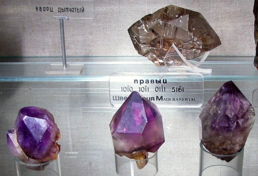
In the foothills and mountains of the Urals, the subsoil is full of untold riches: copper, iron, nickel, gold, diamonds, platinum, precious stones and semi-precious stones, coal and rock salt...
This is one of the few areas on the planet where mining began five thousand years ago and will continue to exist for a very long time.
GEOLOGICAL AND TECTONIC STRUCTURE OF THE URAL
The Ural Mountains were formed in the area of the Hercynian fold. They are separated from the Russian Platform by the Pre-Ural foredeep, filled with sedimentary strata of the Paleogene: clays, sands, gypsum, limestones.
The oldest rocks of the Urals - Archean and Proterozoic crystalline schists and quartzites - make up its watershed ridge.
To the west of it are folded sedimentary and metamorphic rocks of the Paleozoic: sandstones, shales, limestones and marbles.
In the eastern part of the Urals, igneous rocks of various compositions are widespread among the Paleozoic sedimentary strata.
This is associated with the exceptional wealth of the eastern slope of the Urals and Trans-Urals in a variety of ore minerals, precious and semi-precious stones.
CLIMATE OF THE URAL MOUNTAINS
The Urals lie in the depths. continent, located at a great distance from the Atlantic Ocean. This determines the continental nature of its climate. Climatic heterogeneity within the Urals is associated primarily with its large extent from north to south, from the shores of the Barents and Kara seas to the dry steppes of Kazakhstan.
As a result, the northern and southern regions of the Urals find themselves in different radiation and circulation conditions and fall into different climatic zones - subarctic (up to the polar slope) and temperate (the rest of the territory).
The mountain belt is narrow, the heights of the ridges are relatively small, so the Urals do not have their own special mountain climate. However, meridionally elongated mountains quite significantly influence circulation processes, playing the role of a barrier to the dominant westerly transport of air masses.
Therefore, although the climates of the neighboring plains are repeated in the mountains, but in a slightly modified form. In particular, at any crossing of the Urals in the mountains, a climate of more northern regions is observed than on the adjacent plains of the foothills, i.e.
e. climatic zones in the mountains are shifted to the south compared to the neighboring plains. Thus, within the Ural mountainous country, changes in climatic conditions are subject to the law of latitudinal zonation and are only somewhat complicated by altitudinal zonation.
There is a climate change here from tundra to steppe.
Being an obstacle to the movement of air masses from west to east, the Urals serves as an example of a physical-geographical country where the influence of orography on climate is quite clearly manifested. This impact is primarily manifested in better moisture on the western slope, which is the first to encounter cyclones, and the Cis-Urals. At all crossings of the Urals, the amount of precipitation on the western slopes is 150 - 200 mm more than on the eastern.
The greatest amount of precipitation (over 1000 mm) falls on the western slopes of the Polar, Subpolar and partially Northern Urals.
This is due to both the height of the mountains and their position on the main paths of Atlantic cyclones. To the south, the amount of precipitation gradually decreases to 600 - 700 mm, increasing again to 850 mm in the highest part of the Southern Urals. In the southern and southeastern parts of the Urals, as well as in the far north, the annual precipitation is less than 500 - 450 mm.
Maximum precipitation occurs during the warm period.
In winter, snow cover sets in in the Urals. Its thickness in the Cis-Ural region is 70 - 90 cm. In the mountains, the snow thickness increases with height, reaching 1.5 - 2 m on the western slopes of the Subpolar and Northern Urals. Snow is especially abundant in the upper part of the forest belt.
There is much less snow in the Trans-Urals. In the southern part of the Trans-Urals its thickness does not exceed 30 - 40 cm.
The Ural folded structure belongs to the vast Paleozoic folding belt, occupying the space between the Russian and Siberian platforms. The folded strip of the Urals is the western elevated part of the belt. A peculiarity of the geological structure of this strip is the meridional strike of the structures, although in some places there are some deviations from this direction.
The complex geological structure of the Urals is the result of a long history of development. According to A. A. Pronin (1959), the Ural geosyncline arose at the end of the Archean - the beginning of the Proterozoic. The tectonic processes that took place then created an ancient crystalline foundation.
Later, in the Proterozoic and Paleozoic eras, sediment accumulation occurred in the deep marine basins of the geosyncline. It was more than once replaced by orogenic movements, during which folding and fractures of the earth's crust were accompanied by volcanism, the introduction of intrusions, as well as uplifts and subsidences. As a result, mountains arose that were destroyed under the influence of denudation. Then, in their place, seas reappeared and sediment accumulated.
Orogenic movements in the Urals occurred in different eras. At the end of the Proterozoic (during the Riphean folding), the Precambrian strata were dislocated and broken by meridional faults into large blocks, which then experienced vertical movements. Subsequently, anticlines were formed from them. With them the ancient rocks of the Urals came to the surface.
The Urals experienced strong orogenesis at the beginning of the Paleozoic - during the Caledonian era and at the end of the Paleozoic - during the era of the Hercynian (or Variscan) folding. For the Urals, the Hercynian orogeny was final. He determined the main features of tectonics, and the uplifts that accompanied this folding created high folded ridges at the end of the Paleozoic in place of the Urals and Trans-Urals.
Lower Paleozoic deposits are widespread in the Urals and are represented by strata of the Ordovician, Silurian, Devonian and Lower Carboniferous periods. These strata consist of a variety of marine sediments (limestones, sandstones, shales), sometimes metamorphosed. On the eastern slope of the Urals, among Silurian and Devonian deposits, volcanic rocks (lavas and tuffs) are widely developed, which indicates strong volcanic activity in those times.
Upper Paleozoic (Middle, Upper Carboniferous and Permian) sedimentary deposits are distributed only on the western slope of the Urals. This is explained by the fact that on the eastern slope the Hercynian folding and uplift began earlier - from the middle of the Carboniferous period. On the western slope they occurred later - in Permian time. Here, in the Upper Carboniferous and partly Permian times, ordinary marine sediments were deposited: limestones, conglomerates, sandstones. In the Kungurian (later time of the Lower Permian era) they were replaced by sediments of shallow bays and lagoons, and later, when the seas completely disappeared from the western slope of the Urals, continental sediments began to be deposited: variegated clayey strata - products of destruction carried down from the Hercynian mountains that rose to the east Ural.
All this determined the differences in the geological structure of the eastern and western slopes of the Urals. On the eastern slope, folding was not only earlier, but also more intense, and therefore its tectonics is more complex: the folds are usually compressed, often overturned and recumbent. They are often torn and form so-called scaly structures. The folding was accompanied by powerful intrusions of igneous rocks, especially granites.
On the western slope of the Urals, mostly simple folds arose, rarely with discontinuities; igneous rocks were almost not intruded. Simultaneously with the uplift of the Hercynian Urals, a deep marginal trough arose at its junction with the Russian Platform, which was filled with sediments carried from the mountains. In the last stages of the Hercynian orogeny (end of the Permian - beginning of the Triassic), the folded structures of Pai-Khoi, Vaigach, and Novaya Zemlya were formed.
The Hercynian orogeny completed the geosynclinal development of the Urals. After this, platform development began, and tectonic movements no longer reached great intensity. The Mesozoic and Paleogene in the Urals were a relatively quiet period tectonically. Experiencing only small uplifts, the Urals were land that was subject to denudation. Only on the eastern slope in Triassic and Jurassic times did separate subsidences occur, where coal-bearing sediments accumulated, then folded into gentle folds. These movements are considered as an echo of the Cimmerian orogeny, which occurred in neighboring geosynclinal areas.
The Hercynian Mountains of the Urals were destroyed from the beginning of the Mesozoic and gradually turned into low mountains, in places becoming undulating plains. Mesozoic and Paleogene deposits are not widespread in the Urals, since destruction and demolition prevailed during this period. These are Triassic-Jurassic continental deposits of Mesozoic depressions and sediments of seas that penetrated the outskirts of the Urals. The Cretaceous and Paleogene seas transgressed from Western Siberia and flooded significant areas on the site of the eastern slope of the Urals and Pai-Khoi. In some places, the sediments of these seas survived subsequent erosion. At the very end of the Tertiary time, the Caspian transgression, called Akchagyl, approached the Southern Urals along the ancient valleys of the Volga, Kama and Belaya. In many areas in the Urals, loose weathering products formed in the Mesozoic and Paleogene have been preserved on the leveled surface of Paleozoic rocks. This ancient weathering crust is widespread on the plains of the Trans-Urals.
From the Neogene, young tectonic movements began and continued into Quaternary time (Anthropocene), which were a reflection of the Alpine orogeny. They did not reach great strength in the Urals and were expressed in arched uplifts and individual block movements along fault lines. This transformed the highly leveled terrain of the Tertiary Urals into the modern low and mid-altitude Ural Mountains, which were dissected by rivers.
During glacial times, the northern regions of the Urals underwent glaciation, leaving glacial deposits and traces in the relief. In the Far North, in Quaternary times, when vast areas subsided, the Barents and Kara Seas arose, and uplifts along fault lines created the islands of Novaya Zemlya and Vaygach among them. When the transgression was most widespread in the north (boreal transgression), the sea approached the foot of the Polar Urals. The Pai Khoi ridges at that time were islands.
Weak manifestations of seismicity indicate that tectonic movements in the Urals have not stopped even now. According to the Sverdlovsk Observatory, about 40 small earthquakes have been recorded in the Middle Urals over the past 150 years (Malakhov, 1951).
Loose Quaternary sediments cover Paleozoic bedrock. These are alluvial deposits of river terraces and floodplains, colluvium of slopes and eluvial weathering products on mountain tops (placers). In the north of the Urals, glacial accumulations and sediments of boreal transgression are common.
When considering the geological structure of the Urals, large and complex tectonic uplifts (anticlinoria) and subsidences (synclinoria) that arose during geological development are distinguished. They extend along the Urals and are complicated by structures of smaller uplifts and subsidences, individual anticlines and synclines. Large uplifts are usually separated from neighboring depressions by deep faults. Intrusions of deep rocks penetrated along them, volcanic eruptions occurred, and movements of individual blocks occurred.
The axial zone of the Ural Mountains is formed by the largest tectonic structure of the axial, or Ural-Tau, anticlinorium. From the west in the Southern Urals it is adjacent to the Bashkir anticlinorium. In these geoanticlinal uplifts, the most ancient rocks in the Urals emerge to the surface - metamorphosed strata of the Proterozoic, Cambrian and Ordovician, intensely dislocated and consisting of crystalline schists and quartzites.
On the western slope of the Urals there are large structural-tectonic uplifts, in which ancient strata of the Lower Paleozoic and Precambrian also come to the surface. Synclinal subsidences are composed of younger Paleozoic rocks (Devonian, Carboniferous) (Zilair synclinorium in the Southern Urals, etc.). The folded structure of the Urals is separated from the Russian Platform by the Pre-Ural foredeep, filled mainly with Permian and partly Upper Carboniferous sediments. These are mainly products of the destruction of the Hercynian Urals. Within the trough itself there are depressions separated by protrusions of older rocks.
The eastern slope of the Urals is characterized by relatively narrow troughs - the Tagil and Magnitogorsk synclinorium. They are filled with volcanogenic strata of the Silurian, Devonian, and partly Lower Carboniferous, from lavas interlayered with sandstones and limestones. These strata are intruded by numerous intrusions of igneous rocks of different compositions. Granite intrusions are especially large. Most of the intrusions formed during the Hercynian orogeny. A strip of intrusions of basic and ultrabasic rocks (gabbro, peridotites, dunites) stretches along the boundary of the metamorphic rocks of the axial anticlinorium with the volcanogenic strata of the Tagil synclinorium, separated by deep faults.
The Ural-Tobolsk anticlinorium to the east is formed by metamorphosed and dislocated strata of the Lower Paleozoic, partly Precambrian, with intrusions of granites, basic and ultrabasic rocks. Mesozoic depressions contain Triassic-Jurassic and Cretaceous sediments and small areas of Paleogene marine sediments are preserved. Even further to the east, the Paleozoic structures of the Urals are submerged under the young sediments of the West Siberian Lowland. In the Northern and Polar Urals, the Ural-Tobolsk anticlinorium and most of the Tagil synclinorium are hidden under them, and in the Southern Urals the eastern tectonic zone is expanded and includes east of the Ural-Tobolsk uplift and part of the Ayat synclinorium.
The meridionally elongated Ural structures in the south end in Mugodzhary, going under the cover of Mesozoic and Tertiary sediments. In the north of the Urals they continue in the folds of Pai-Khoi, Vaygach Island and further on Novaya Zemlya (Ivanova et al., 1957). The structures of the latter form a large Pai-Khoi (or Vaigach) anticlinorium. It has a northwestern strike and is separated from the Polar Urals by a strip of young subsidence. The Pai-Khoi anticlinorium is composed of dislocated strata of the Middle and Upper Paleozoic, characteristic of the western slope of the Urals.
The structures of Pai-Khoi and Vaygach arose in the last stage of the Hercynian orogeny, and they are characterized by a different strike, different from the Uralian. Even further to the north, the folded structures acquire a northeastern direction and belong to another large uplift - the North Novaya Zemlya anticlinorium. It is also formed by dislocated Paleozoic rocks and was formed as a result of Hercynian folding.
Due to the meridional elongation of geological structures and the asymmetry of the structure, when crossing the Urals, several stripes (zones) are distinguished, different in rock composition, tectonics, and, as a consequence, a complex of minerals. In the middle part of the Urals, where this is especially pronounced, six such stripes are distinguished (Nalivkin, 1943). Starting from the west, within the Pre-Ural trough and the western slope, there is the first strip of Paleozoic sedimentary rocks (Permian, Carboniferous and Devonian) with a predominance of limestones, dolomites, sandstones and chemical sediments (gypsum, salts).
The axial anticlinorium corresponds to the second band - ancient metamorphosed rocks of the Precambrian and Lower Paleozoic, mainly crystalline schists and quartzites. At the border of the axial uplift and the Tagil synclinorium, a third band is distinguished - deep intrusions of gabbro, peridotites, and dunites. In some places these rocks have changed, partially turning into serpentines (serpentines).
To the east is the fourth, “greenstone” band, formed by volcanogenic strata of the Silurian and Devonian, mainly from porphyrites and their tuffs, which are interbedded with metamorphosed sedimentary rocks. These rocks are confined to the Tagil-Magnitogorsk synclinorium, and the zone is called “greenstone” because during metamorphism many minerals and rocks received a greenish tint.
Further to the east follows the fifth strip - granite intrusions, which differs from the previous one in the distribution of large granite intrusions, the last, sixth - is a strip of dislocated Paleozoic rocks, broken through by intrusions. It is formed by rocks of the Ural-Tobolsk uplift.